- News
- World News
- US News
- 6 alligator-infested rivers in the US: From the St. Johns River in Florida to the Brazos River in Texas
Trending
6 alligator-infested rivers in the US: From the St. Johns River in Florida to the Brazos River in Texas

US rivers with the largest alligator populations
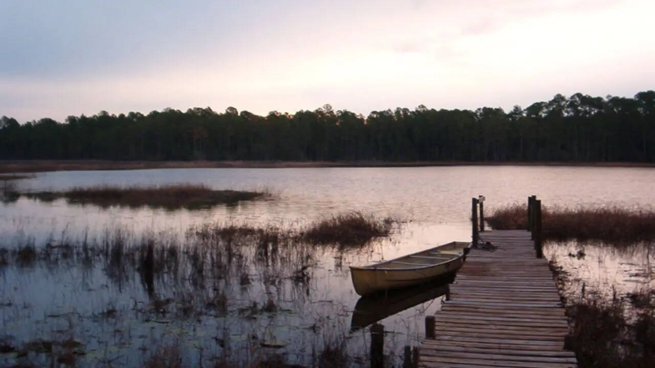
Most alligator-infested rivers in the United States
St. John's River, Florida
Pascagoula River basin, Mississippi

PC: The Nature Conservancy
Pearl River, Louisiana

Savannah River, Georgia and South Carolina

PC:
Brazos River , Texas

Waccamaw River, Carolinas


About the AuthorTOI World Desk
End of Article
Follow Us On Social Media

Hot Picks
Top Trending
Tired of too many ads?go ad free now
Trending Stories
In World
Entire Website
- Britain’s oldest known prehistoric art confirmed in Derbyshire Cave, dating back more than 13,000 years
- London tube strike underway as major travel disruption hits capital
- This rare gemstone found by a 12-year-old in Jewish village was cursed by Jesus
- Sri Lankan family faces deportation despite mother's UK visa extension: Children must leave
- Debt, inflation & IMF dependence: Pakistan is still spending $900,000 every month on US lobbying
- 6 alligator-infested rivers in the US: From the St. Johns River in Florida to the Brazos River in Texas
- What looked like simple red stains turned out to be Britain’s oldest cave art from 17,100 years ago
- Quote of the day by Chinese philosopher Confucius: “Before you embark on a journey of revenge, dig two graves.”
- An alternative to the Strait of Hormuz? Why Iran is eyeing Yemen's Bab al-Mandab
- Operation Checkmate: 30 Indians held for illegally working as truck drivers in US, deportation likely
- US-Israel-Iran War Live Updates: Trump demands changes to Iran pact, pushes for stricter Hormuz terms
- West Bengal BJP shuts doors on TMC rebels, vows to prevent 'Trinamoolisation'
- Trump-Netanyahu split? Conflicting accounts of Israel's Lebanon operation emerge after 'heated' phone call
- 'People think I love to hit every ball, but ...': Vaibhav Sooryavanshi's answer after R Ashwin's tease goes viral
- ITR filing FY 2025-26: Top reasons salaried taxpayers should wait till mid-June to file income tax returns
- “Signed an absolute monster”: Kansas City Chiefs newcomer’s jaw-dropping transformation has NFL fans doing double takes
- "This is a 10-month relationship": Justin Herbert's romance with Madison Beer has NFL analyst seriously questioning his focus ahead of season
- Why was Jack Doherty arrested? Viral handcuff video sparks heated debate across social media
- Ella Buffin swaps England for Netherlands World Cup dream while Micky van de Ven steals spotlight
- Rafael Jodar faces new French Open kid mascot backlash while fans revisit ball girl controversy
Tired of too many ads?go ad free now


Explore Every Corner
Across The Globe
Rick AdelmanSouth KoreaUS Iran WarAnthropic IPOKansas City ChiefHardik PandyaCBSE answer bookCBSE 12 re-evaluationCBSE OSMMalaysia social media banIndia-Oman trade agreementBhopal RapeDelhi LPG BlastCUET UG 2026 admit cardsJEE Advanced TopperLarry Fitzgerald SrFortnite Chapter 7 Season 3 Release DateTwisha SharmaFortnite Chapter 7 Season 3Vaibhav SooryavanshiRajat PatidarVirat KohliFrench Open 2026NFL Trade RumorsLalit ModiIndian Navy Agniveer ApprenticePlayStation State of Play June 2026AnnamalaiShanimol OsmanNEET re-exam

Hot on the Web
Gaurav GeraLalit ModiTP AggarwalSuriyaDridam OTT ReleaseTrisha KrishnanMini MathurTraditional Desi DrinksUnique Sea SnakesPankaj BhadouriaVarun DhawanAvengers DoomsdayTripti DimriAnushka SharmaNarendra ModiBarack Obama QuoteRakesh BediSpider Man Brand New DayPM Modi DietSalman KhanDrishyam 3 Box Office CollectionKaruppu Box Office CollectionBlast Box Office CollectionPati Patni Aur Woh Do Box Office CollectionChand Mera Dil Box Office CollectionKattalan Box Office CollectionGuru Purnima 2026World Largest River IslandVaibhav SooryavanshiHoroscope TodayMahmud Sadis BubaParveen ShaikhUS Powerball LotteryGemini AI Prompts For EidOla Compensation CaseINS KolkataNyt ConnectionsMercedes Benz G580Jellyfish That Never DiesGoogle Release MosquitoesDelivery Firm Refund DeniedCaptions For Instagram Posts
Trending Topics
Virat KohliWorld Cup 2026K AnnamalaiCockroach Janta PartyVaibhav SooryavanshiPV SindhuSigmund FreudSerena WilliamsTravis KelcesJosh JacobsKylian MbappeUP Kabaddi Player MurderBengal Forgery CaseBhopal RapeSuvendu AdhikariRamesh ChennithalaHeatwave North IndiaUK student MurderMohammad YousufEbola bengaluruIran WarDonald TrumpIowa ShootingStrait of HormuzDave FijiRussia Ukraine WarFlorida OpenAI SuedIvanka TrumpTrump Netanyahu SplitPakistan DebtLuis SuarezSam AltmanFlorida Sues OpenAISundar PichaiAmazon MusicJensen HuangAsus ProartMeta LayoffsGarena Free Fire MAX Redeem CodesPeroxide CodesGenshin Impact Codes
Popular Categories
HeadlinesSports NewsBusiness NewsIndia NewsWorld NewsInternational SportsHealthIndian TV ShowsBreaking NewsTravelTOI Home Decor AwardsAstrologyDeorhiAutoTechnology NewsGold Rate TodayWeather TodaySilver Price TodayDelhi Weather TodayPetrol Price TodayDiesel Price TodayCNG Price TodayLPG Price TodayPetrol Price MumbaiDelhi AQIIs Bank Open TodayMumbai AQI TodayIs Bank Open TomorrowPublic Holidays in JuneBank Holidays in June
Trending Videos
The Untold Story Of The CIA, The T-72 Tank And Delhi Gymkhana ClubJupiter's Biggest Transit : Cancer, Leo & Virgo Are Entering Their Golden Era | Ft. Prakash JoshiUS Immigration Crackdown: 30 Indian Truckers Arrested In Operation Checkmate'We Reached 207 Without Imports': Bengal BJP Shuts Door On TMC Leaders Ahead Of 2026 Polls‘Starobelsk Attackers Won't Escape…’: Putin Vows Hunt For Perpetrators, Demands AccountabilityMamata Faces Fresh Challenge As TMC MLAs Rally Behind Rebel Ritabrata Banerjee | WatchCentre Can Take Back Leased Land For Public Interest, Says Khattar; Delhi Plan Soon?‘It Was A Russian Drone’: Ukraine Doubles Down On Romania’s Geran-2 Claims, Rejects Shootdown TheoryTrump's Fury Boils Over As He Clashes With Netanyahu Over LebanonShashi Tharoor Calls Full Vande Mataram Rendition At Official Events An "Unnecessary Imposition"Israel’s UN Envoy Defends Lebanon Operations, Warns Of More Action | WatchWho Is Maa Baglamukhi? | Biggest Secrets of 10 Mahavidyas | Ft. Mahant Alok Ji MaharajRajeev Verma Reveals Why He Walked Away from BollywoodInside Virat Kohli and Anushka Sharma’s Stunning ₹34 Crore Mumbai HomeAsha Parekh recalls ‘Kati Patang’ shoot chaos; fans threw stones to catch a glimpse of Rajesh KhannaTrump's Weekend Golf Getaway Takes UNEXPECTED Turn As Mystery Blonde Appears | WATCHKyiv Hit By Russian Strikes Targeting Residential Areas, Key Leadership HubGemini: Jupiter Brings Money, Success & Sacrifice? Jupiter Biggest Transit | Ft. Prakash Joshi
Latest News
Hazaribag man drowns while fishing in lake"Behen Darr Gayi!": Fans relive ‘Bhagam Bhag’ era after watching Akshay Kumar's 'Bhooth Bangla' trailerMBOSE HSLC result 2026 to release tomorrow: Check details hereIran war risk: JPMorgan CEO Jamie Dimon warns of oil shocks, sticky inflation and higher interest ratesMake your clutch last longer with these easy driving tips“Three-against-one situation”: El Rubius opens up on being “targeted” in MrBeast’s viral $1M challengeBihar BTSC lab assistant notification released for 1091 posts at btsc.bihar.gov.in; apply hereIPL craze costs techie Rs 1.46 lakh in fake RCB vs CSK ticket scamRaising “robot-proof” kids: Why creativity and curiosity matter more than everInside ‘Satguru Sharan’: Exploring Saif Ali Khan and Kareena Kapoor Khan’s Rs 100 crore Bandra homeHow selling Alaska in 1867 was a costly mistake for Russia'Hera Pheri 3 is coming': Paresh Rawal dismisses delay reports and reveals he will 'start shooting soon'US-Iran War: A daring rescue Hollywood blockbuster is on its way. Till then, pick your favourite from these 10 films on bringing someone home against all oddsKolkata team unveils fan mural at Rash Behari Avenue, celebrating city’s first loveHow US spread a lie to rescue a pilot of a jet shot down in IranNetflix unveils ‘VOID’, an AI model that can change a movie plotAI data centers are causing 'stress' not just to tech companies, but also private insurers"Trans women are.....": Clavicular’s viral moment with trans women sparks fresh conversation on internet culture
Copyright © 2026 Bennett, Coleman & Co. Ltd. All rights reserved. For reprint rights: Times Syndication Service